Regenerate the land. Build the future.
-
1I want to certify
Create carbon credits
Certify carbon credits for your biobased construction materials and create a flywheel.
-
2I want carbon credits
Carbon credits purchase
Get highly transparent carbon credits of biobased construction materials transforming the construction sector
-
3Services
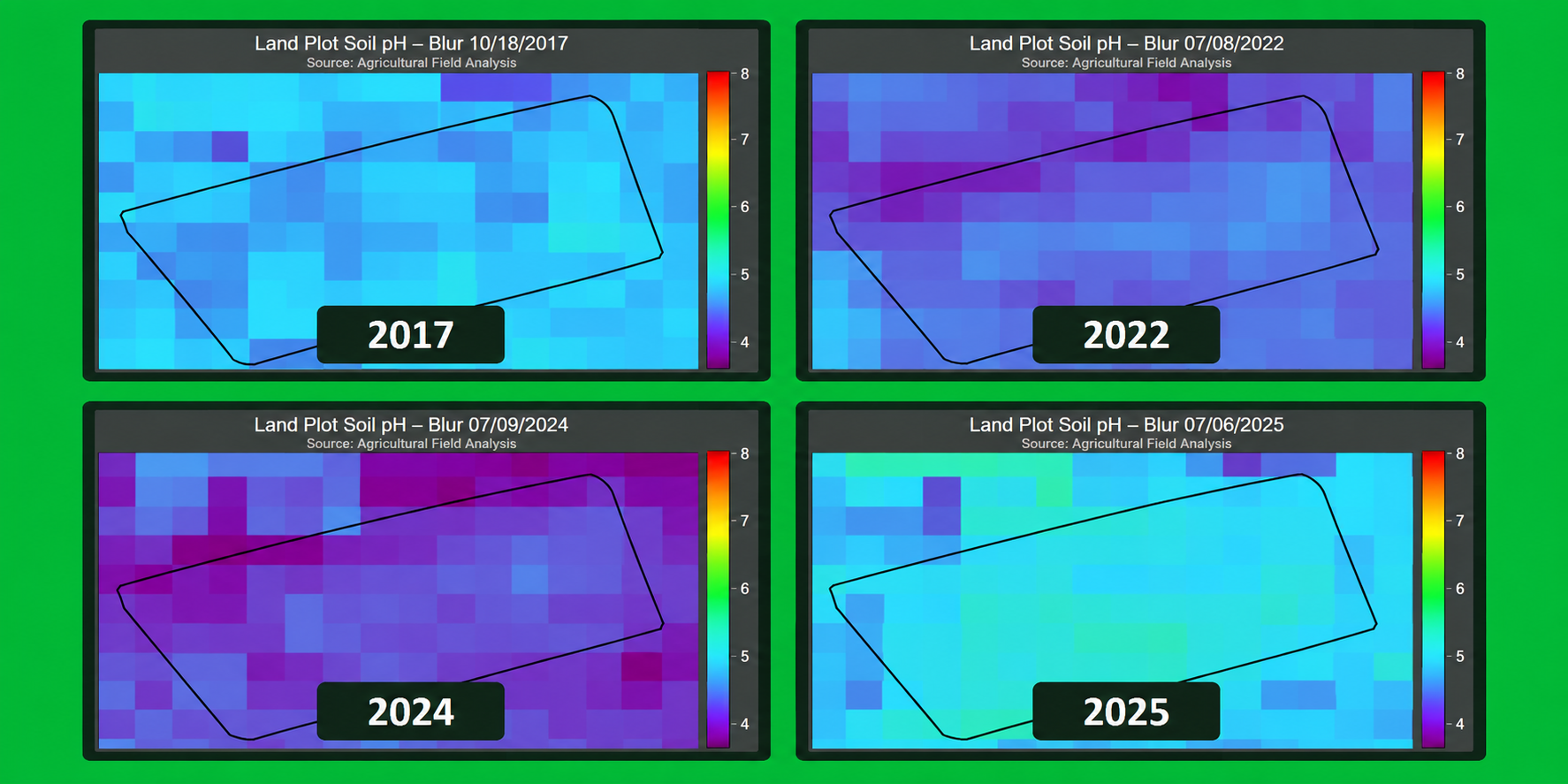
Earth+ Scan soil health monitoring
Reveal your land’s hidden dynamics, improve productivity, and reduce costs remotely with satellites and AI
-
4I want to restore
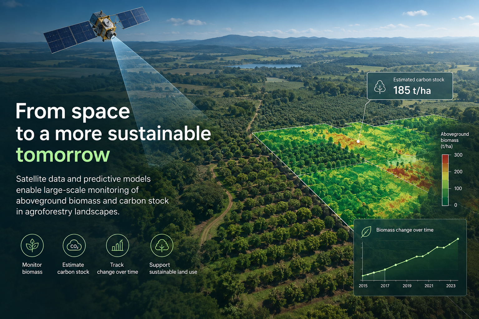
Earth+ Scan AGB/Carbon Stock monitoring
Quantify above ground biomass and carbon stock remotely with satellites and AI


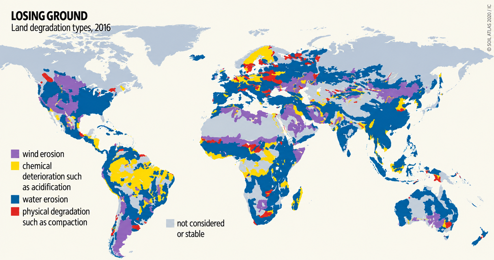
Soil degradation
-
52 %
OF AGRICULTURAL LAND IS DEGRADED WORLDWIDE
-
10 trillion USD
DEGRADATION HAS HUGE ECONOMIC IMPACT
Annual cost of degradation ≈ USD 6–10 trillion (~10-17% of global GDP).
UNCCD & IPBES joint estimate, 2022
Loading map data
(0 co2 loaded)CO2 emissions
-
103.539.726 tons/dayCO2 emissions
-
18.197 MILLION €/daySocietal costs
-
Manufacturing
-
Waste
-
Transportation
-
Power
-
Fossil fuel operations
Sources: NASA, Nature Journal
Loading map data
(0 pfas loaded)PFAS pollution
-
1.370 tons/dayPFAS emissions
-
43.835 MILLION €/dayPFAS societal costs
-
Known sites
-
Presumptive sites
-
User sites
Sources: Le Monde, Forever Pollution Project, ChemSec
AGB POC
Earth+ and Fujitsu completed a proof of concept of how satellite data and predictive models can enable scalable monitoring of aboveground biomass and carbon stock in agroforestry, including uncertainty estimation. It demonstrates how Earth+ Scan can complement and reduce field measurements and provide reliable environmental data for sustainability reporting, regenerative agriculture impact monitoring and better land-management decisions.
Make your stakeholders proud. Including your mom.
Lead purposeful and profitable business projects with us.
Go to services